 Mexico
 Country Snapshot: Climate Overview
Mexico is effectively divided into two halves by the tropic of Cancer, which runs through the center of the country. To the north a temperate climate is experienced, while south of the division the climate is more tropical. Most of the country is warm and experiences many hours of sunshine throughout the year. Mexico has a pronounced wet and dry season and is also affected by hurricanes striking the country each year.
Seasons
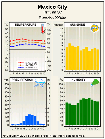
Wet season lasts from June to November. The wet season incorporates the hurricane season. Given Mexico's long coastline, it is usual for the country to be struck by a hurricane at least once a year. When storms occur, heavy rainfall is associated with winds of up to 200 kilometers per hour (124 miles per hour) that can cause extensive structural damage. July is the wettest month, with Mexico City receiving an average of 160 millimeters (6.3 inches) of rainfall.
Dry season is from December to May. Significantly less rain is experienced everywhere in the country during the dry season. Mexico City records just 5 mm (0.2 in) of rain during February, which is the driest month. May is the warmest month of the year with an average temperature of 26°C (79°F) in Mexico City.
Regional Variations
Mexico experiences regional climatic variation as a consequence of altitude and latitude. The country can be divided into the following climatic regions.
The coastal plains and Yucatán Peninsula are low-lying regions, where climate is moderated by the surrounding water. The east coast is warmer due to the influence of the Caribbean Sea, whereas the west coast is cooled by the cold California current. There is a small part of the country around the city of Tijuana that experiences a typical Mediterranean climate, with coastal fog and maximum rainfall during the winter months.
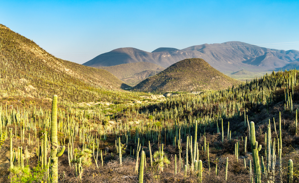
Northwest Mexico is a desert region receiving 300–600 mm (12–24 in) of precipitation each year. The region is susceptible to cold air masses moving south from continental North America. In winter this can bring conditions to below freezing and occasional snowfalls have been recorded even below the Tropic of Cancer.
Plateaus and high mountains cover two thirds of the remainder of Mexico and the altitude has a significant effect on the temperature. The Cordillera Neovolcánica is the main central mountain range and rises well above 2,000 meters (6,560 feet). An annual temperature range of just 8–12°C (46–54°F) and year-round snow cover is experienced on the highest peaks, which extend up to 5,636 m (18,500 ft) above sea level.
Copyright © 1993—2024 World Trade Press. All rights reserved.